
The first step in preparing for the final flight is path predictions. In order to make sure the balloon does not fly too far away, land in an inappropriate location, or fall into a body of water, we can use another aptly named tool by habhub: the CUSF Landing Predictor.
Once opened, you should see a map with an options dialogue at the bottom-right. I will go through each option one-by-one in order to make sure everything is filled out correctly.
- Launch Site: Leave this as is for now.
- Latitude/Longitude: Wherever you plan to launch the balloon. If you're unsure at the moment, just put wherever you currently are. If you don't know your exact coordinates, you can use http://www.mapcoordinates.net/ to find them by simply entering your address.
- Launch altitude (m): Your altitude relative to sea level where you launch the balloon. Once again, follow the instructions mentioned above to obtain this info.
- Launch Time (UTC): The time you plan to launch the balloon, in the UTC time zone. For reference, here is the current time in UTC, based off your computer's clock. If your computer's clock is incorrect, so will be this. Keep this in mind.
- Launch Date: Date of launch, again in UTC.
- Ascent Rate (m/s): Here's where things get a bit more complicated.
- Burst Altitude (m): This too.
- Descent Rate (m/s): And this.
In order to find these two, we can use some documentation found on the UKHAS wiki to help us:
https://ukhas.org.uk/guides:balloon_data
For my balloon, the product's page lists the balloon's weight as 300g, and the burst diameter as 12' 4", or ~378cm. Going by these specifications and searching through the table on this wiki, we can see that this balloon is most likely a 300g Totex balloon, as these parameters match up exactly. This table also lists the rate of ascent and burst altitude, although these are in the wrong units. Rate of ascent needs to be converted from m/min to m/sec, and the bursting altitude needs to be converted from km to m. You can use Google for these conversions, as it is the simplest way to obtain them.
All that remains at this point is the descent rate. I couldn't find any descent rate calculators specifically made for weather balloons, but I did find one for model rockets, which should work just about as well.
http://www.onlinetesting.net/cgi-bin/descent3.3.cgi
Here's what to enter:
- Mass: Mass of your payload. Make sure to select whatever unit you measured in, most likely grams.
- Parachute Diameter: Diameter of your parachute, either provided to you by the seller or measured yourself.
- Shape of Parachute: Self-explanatory. Most likely round.
- Method of Measurement: Keep at "Diameter" unless using a different type of parachute.
- Expected Altitude: Can be left blank.
Click calculate, and you should now have your answer. Make sure to pay attention to the units, and then enter the measurement listed in meters per second. Now that all the info is taken care of, click "Run Prediction". You should now have a path that look a bit like this:
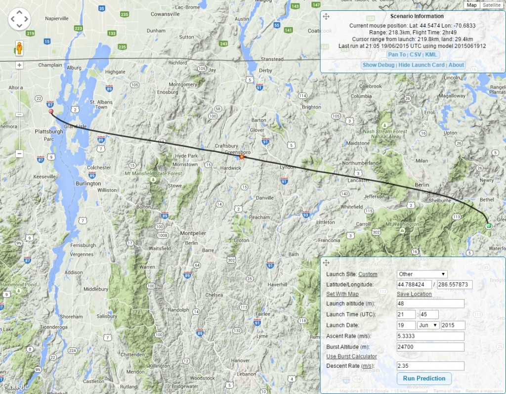
Fig. 1: Example of a predicted flight path.
Keep in mind that this prediction will change every day as weather predictions change, so make sure to keep yourself up to date before the launch.
Legality << >> Payload Container
